Визуализация данных - самый важная и часто самая хромающая часть любого исследования. Геофизика - отличный тому пример. Как представить трёхмерные модели блоков земной коры поперечником в десятки и тысячи километров? Чаще всего ограничиваются отдельными сечениями-разрезами: ведь даже на картинке со всей 3D структурой всё будет наложено и переналожено десятки раз.
Data visualization is one of the most important parts of any research. That's why it is usually absent. For example, in geophysics. How one can represent 3D blocks of the Earth's crust 10 to 1000 km wide? Most of people just end up with one or two cuts through it. Even a 3D image on a 2D plane will have lots of overlapses, so ii might be beautiful, but not very clear.
Три блока ещё на технологической подложке, четвёртый уже
отодран
(наиболее эффективно использовать зубы челюсти и тонким ножом).
Three blocks still stay on a technological bed, and the fourth one is already free. The most effective removal tools are your own teeth and a thin knife.
Случайно я разведал (по совсем другому вопросу), что в библиотеке моего университета стоит бесплатный 3D принтер (для всех студентов и сотрудников). Ростки коммунизма прорывают капиталистический строй. Вообще, как оказалось, в Австралии эта услуга доступна во многих публичных библиотеках за более чем вменямые деньги.
Occasionally I learned (I was checking for a very different thing) there is a free 3D printer for students and staff at my uni's library. Socialism and money-free future tears capitalistic tissue of the society. I was surprised that 3D printing is available across numerous country-side library, and the price is very reasonable.
Естественно, два факта увязались очень просто. Я решил распечатать геофизическую модель на 3D принтере.
Two facts combined in my head immediately. I can print out my geophysical models!
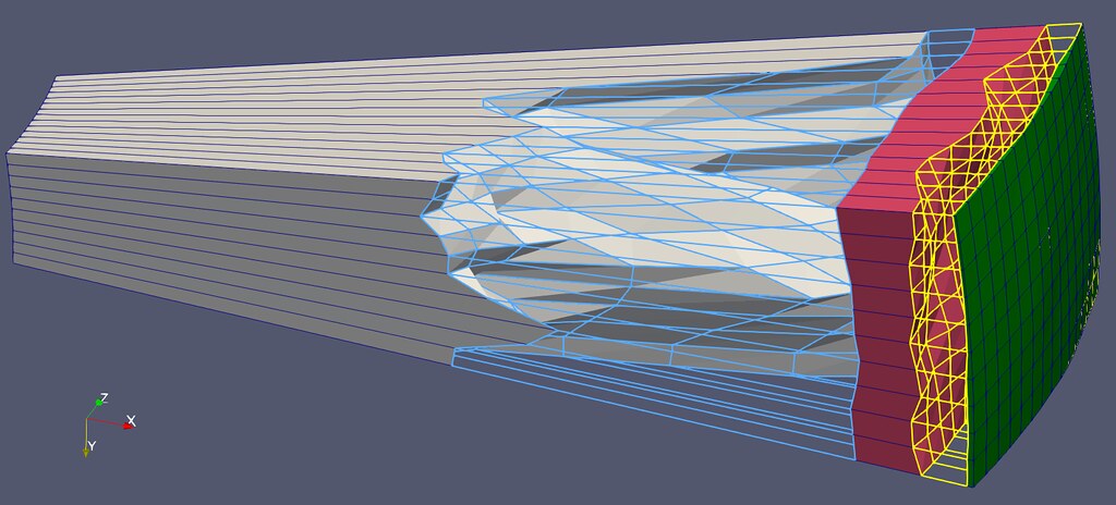
Каждая из зон - слой модели с множеством ячеек физических свойств. Два прозрачны.
Each volume piece is a layer with numerous cells of different physical properties. Two layers are transparent.
Быстрая проверка показала, что формат данных, в который я писал результаты расчётов в той программе, над которой я работаю, в два движения переводится в формат STL принтера. Я взял простенькую модель с реальной инверсией геофизики и её распечатал в масштабе - сжав в 20000 раз по всем измерениям (так что 1300 км стала 6.5 сантиметрами), а потом увеличил мощности пластов в 10 раз, и в 100 раз - осадочный чехол (модель заканчивается рельефом).
Luckily the data format I used to output the data computed by the software that I develop can be transformed to 3D printer in couple of clicks. I took a simple but real geophysical inversion model and made a scaled model. I contracted it by factor of 20000, so that 1300 km turned into 6.5 cm, and then I multiplied layer thicknesses by 10, and elevation (and uppermost sediments) by factor of 100.
Понеслось!
Poekhali!
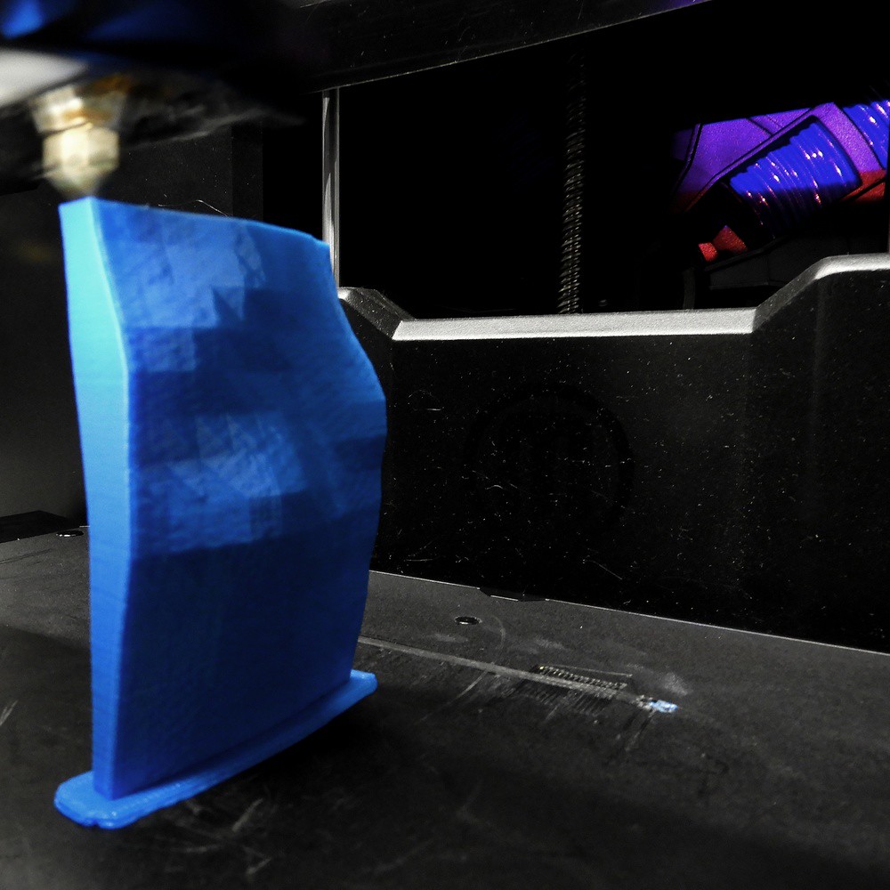
Печатающая головка выдавливает очередной геологический слой. Квадратики - ячейки самой модели.
Extruder prints a geological layer. Squares come from the numerical cells of the geophysical model itself.
Внутри автоматически печатаются рёбра жёсткости. Для нависающих элементов печатаются дополнительных опор.
Stiffeners automatically "appear" within the block. Hanging blocks require supporters, which can be easily removed with knife and fingers.
The printing process is very simple. Just click couple of buttons and do whatever you want nearby to the printer. One should stay around all the time, because numerous issues can happen: (1) bending of a bed (results in deformed model, (2) a thread blocked itself in a coil, and (3) small things during printing can get off the table with or without their bed to fly around, crushing and messing up all the things.
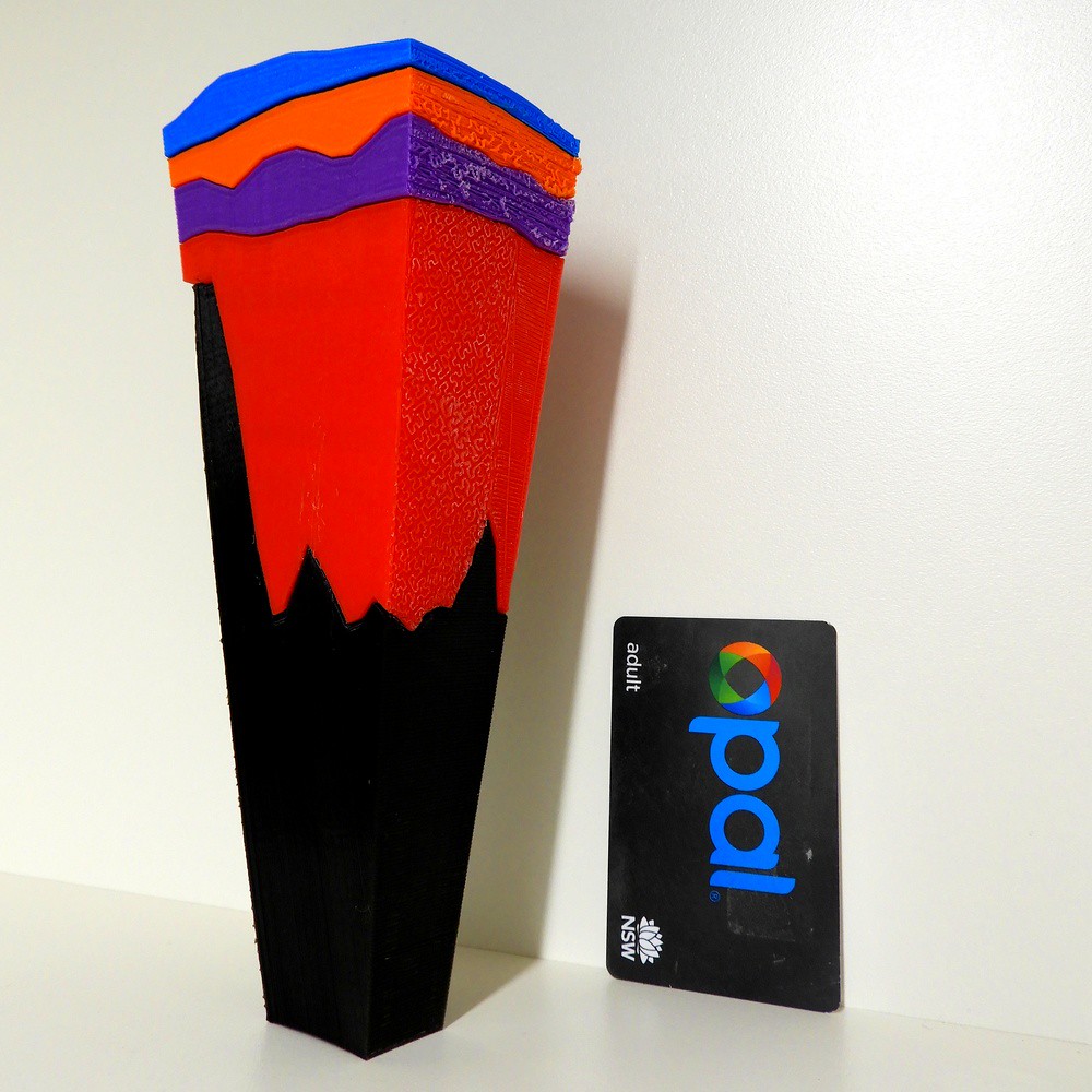
Первая распечатка со всеми недочётами. Факел горит!
Чёрное - мантия до 380 км в глубину
Красное - сублитосферная мантия
Фиолетовое - нижняя кора
Рыжее - верхняя кора
Синее - осадочный чехол (x10 относительно остальной модели)
Чёрное - мантия до 380 км в глубину
Красное - сублитосферная мантия
Фиолетовое - нижняя кора
Рыжее - верхняя кора
Синее - осадочный чехол (x10 относительно остальной модели)
The very first print with all the mistakes. Fire Flare is on!
Black is the Earth's mantle till 380 km in depth
Red is sublithospheric mantle
Violet is the lower crust
Orange is the upper crust
and Blue is sedimentary rock zoomed in by 10
Black is the Earth's mantle till 380 km in depth
Red is sublithospheric mantle
Violet is the lower crust
Orange is the upper crust
and Blue is sedimentary rock zoomed in by 10
Так что призываю каждого (и тебя, да, тебя тоже!) делать наглядные пособия!
And now that your (yes, yes, YOUR) turn to print your work!


Комментариев нет:
Отправить комментарий